South Australia
April 2019
Distance: 12 km (7.5 miles)
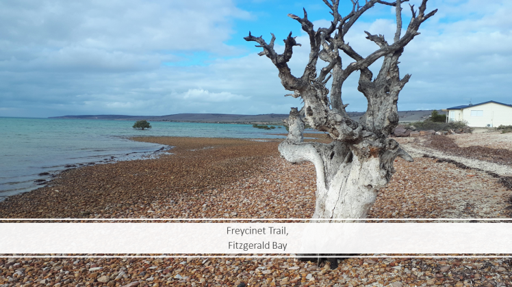
The Freycinet Trail is 391 km from home in a little-known part of South Australia called Fitzgerald Bay. If you have heard of Fitzgerald Bay it may be because of the giant Australian cuttlefish – people travel from all over the world to experience the annual migration of these beautiful sea creatures.
The 12 km Freycinet Trail starts at the northern-most bush camp at Fitzgerald Bay and finishes at Point Lowly. The small bush camp has flushing toilets and running water – we camped here the night before. The road into the campsite is on your right just before the bitumen road runs out and you’ll see a wooden sign that says “bush camp”. Head down the narrow dirt road into the camp site, where you’ll find the beginning of the walk. There’s a sign showing a map of the trail and it also includes some background info. I took 2 photos of the map to help me with my walk and was glad I did. There are 15 interpretive signs along the trail, and I found these really useful to gauge how far along I was.
At the start of the trail you cross a tidal creek. Depending on the tide, you may be able to jump across it, or you may have to get your feet a wet. I’d packed a towel in my backpack to dry off my feet, but didn’t end up needing it.

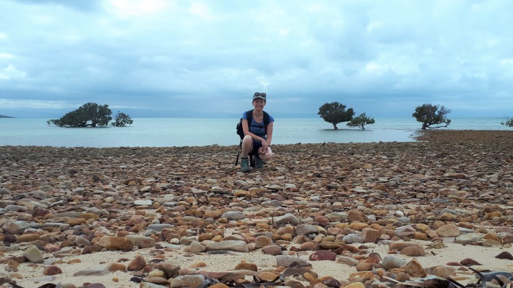
The first 4 km is along the beach – on both sand and pebbles – and also on narrow dirt tracks. It’s for hikers only. The trail isn’t well defined in parts and I found myself going between the beach and up behind shacks intermittently – either way the beach is always on your left-hand side within sight so you’re not going to get lost. I did miss 1 or 2 of the interpretive signs because of this though.
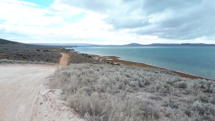
After the first 4 km you’re walking on different terrain. You cross a stock grid and from here on you’re walking on the emergency coastal track. It’s a shared use track, so cars and bikes are also on this road. It’s very exposed to the sun and wind but the views are really spectacular. Drivers wouldn’t be expecting anyone to be walking on this road and may be travelling quite fast over the tops of the hills – on some parts of the road the side is high-up so you would have to scramble up out of the way. I only had 1 car pass me for this 8 km section of the trail.
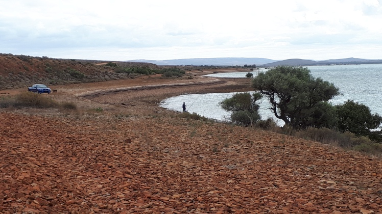
There are several dirt tracks leading off of the left-hand side of the road and down towards the beach – these lead to camping and fishing spots. I followed a couple of these whilst keeping the emergency coastal track in sight still just to keep things interesting.

Number 8 was my favourite interpretive sign. There’s a bench up high overlooking the ocean. I sat down and took a photo to send mum to let her know how far along I was. As I headed back onto the road and looked up I saw my first glimpse of the Pt Lowly Lighthouse. It was a tiny white speck in the distance but it helped give me focus and something to look forward to reaching at the end.
The Freycinet Trail follows the coastline for most of it’s 12km. There’s only one part of the trail that moves away from the coastline towards the end of the walk and it’s really obvious if you have a photo of the map to guide you.
After sign no. 9 you come to a junction – take the bitumen road on your left in towards Pt Lowly. It’s not a particularly pretty part of the walk but you know you’re nearly back amongst civilisation and the Lighthouse isn’t too far away.
When you get to the toilets and playground, turn left here and you’ll see a yellow metal post up ahead on your right. You’ll also see another interpretive sign not long after this on your left. This turn in the trail wasn’t really obvious to me from the map.
Follow this road around and the Pt Lowly lighthouse and it’s little white cottages will soon come into view. Nearly there – 2 more signs and you’re done!

This walk was a challenge for me because I was walking on my own, in unfamiliar territory and it felt remote and exposed in parts. There are hills to tackle once you’re on the emergency coastal track but for the most part it’s relatively flat. I had mobile phone coverage for most of the time.
Extreme care must be taken whilst driving on the roads here as there is a massive population of kangaroos and quite a few emus too. Getting to the bush camp involves driving on a narrow, unsealed, bumpy road.

The Freycinet Trail had been on my hiking list for quite a while. I hadn’t heard of anyone else walking it and had only come across it via the South Australia and Whyalla tourism websites. I’m hoping other hikers will discover my blog post and be inspired to give the trail a go. I loved doing it and it was such a unique hike to tackle solo compared to my local hikes in the Mt Lofty ranges.
Sarina

Beautiful in any weather!! (Except rain.)
LikeLiked by 1 person
It was a different landscape for me to be out walking amongst Nora. It was lovely.
LikeLiked by 1 person
Great post, such an interesting walk obviously. Terrific photos too, so many roos!
LikeLiked by 1 person
The roos were crazy Glenys. And in no hurry to get off of the road!
LikeLiked by 1 person
That looks like a fabulous walk and a great way to explore some coastal landscape. Thanks for sharing, Mel
LikeLiked by 1 person
Thanks Mel. It was a great walk.
LikeLiked by 1 person
Yes, it was…..and the feet are starting to get itchy again!
LikeLiked by 1 person
Happy hiking!!!
LikeLiked by 1 person
What a neat place! The view is amazing!Thanks for sharing.
LikeLiked by 1 person